Dive Log can store coordinates for dive sites that can be used for display on a map or for linking to a route planning application such as the iPhone’s built in Maps application or NAVIGON’s MobileNavigator application (if it is installed on your device).
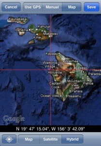
Dive Site coordinates can be entered either manually, via the iPhone’s built in location services (including hardware GPS on most iPhones and iPad WiFi+3G) or by directly locating the site on a map.
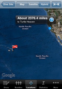
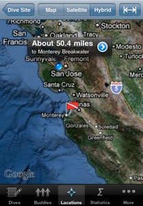
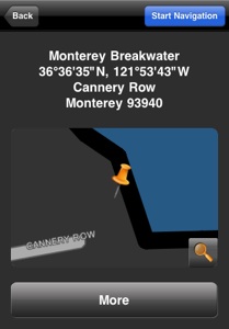
Once you have coordinates for a site, you can view that site location on a map. When your device has sufficient information available to determine your current location, you can ask Dive Log to display the site relative to your current location.
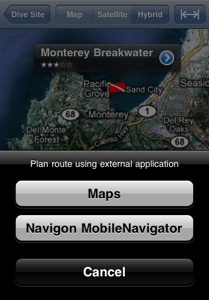
You can request routing information to the site by tapping the disclosure icon on the right hand side of the information bubble for the selected location. The option of using the built in Maps application is always available. You may also be able to get directions via a turn-by-turn navigation application if you have one of NAVIGON’s MobileNavigator versions installed on your device. Note that MobileNavigator may not be able to determine a route depending on which edition you have installed, your current location or the dive site’s location (MobileNavigator does not provide marine navigation for example).
We will add support for other popular other 3rd party navigation applications as the necessary interfaces become available.